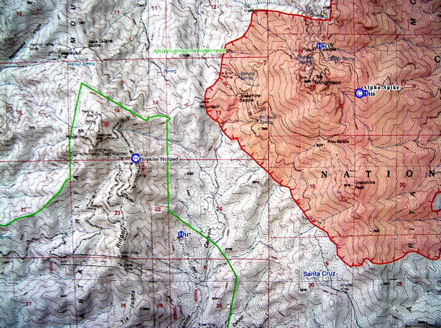
Fire Boundary map distributed Sunday morning.
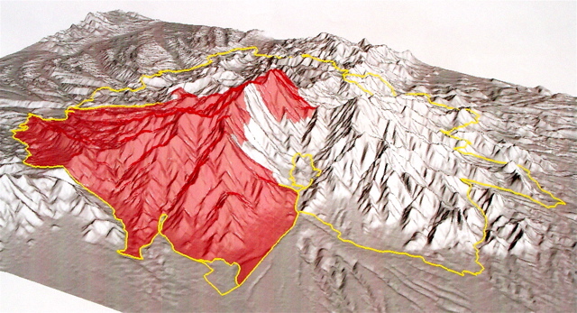
3D Fire Boundary map from N (Wrightson left, Hopkins right, Madera Canyon bottom).
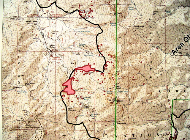
IR Fire Map showing Hot Spots.
MT. HOPKINS FIRE BEHAVIOR FORECAST FOR SUNDAY
(Taken from the Florida Incident Action Plan Day for 07/17/05) "In
Jack Mountain and Josephine Canyon, the fire activity will remain low
in the morning. As the day progresses there is potential for active up
slope crown fire in the timber. This could produce spread rates of 32
chains (1 chain=66 ft) per hour and flame lengths greater than 50 feet."
NUMBERS:
21,500 Acres
40% Contained
$5.5 M cost so far
986 people working on fire.
PHOTOS:
Fire Boundary map distributed Sunday morning.
3D Fire Boundary map from N (Wrightson left, Hopkins right, Madera Canyon bottom).
IR Fire Map showing Hot Spots.